Integration + Participation

Durgerdam Integral Spatial Program

The village of Durgerdam, just north of Amsterdam, has unique scenic qualities. It is a protected village view, has a beautiful location on the IJsselmeer and is surrounded by nature. The Integral Spatial Program (ISP) has been drawn up in close collaboration with residents, Water Board, Province and Municipality and offers starting points for further elaboration on the work to be done on public space and dyke improvement in Durgerdam.

Motive

INTEGRAL SPATIAL PROGRAM

The Water Board Hollands Noorderkwartier / Markermeerdijken Alliance is working on a Preliminary Design (VO), which will be laid down in the ‘Ontwerp Projectplan Waterwet’. At the same time, the City of Amsterdam is working on a development plan for public space and infrastructure in Durgerdam. The Integral Spatial Program of Durgerdam sets the course for the further elaboration of water safety and the design of public spaces in 2019 and beyond. The technical requirements of the Flood Protection Program, the active role of residents of Durgerdam and the collaboration with Palmbout Urban Landscapes have yielded a complete package of starting points with great attention to the characteristic features of the village.
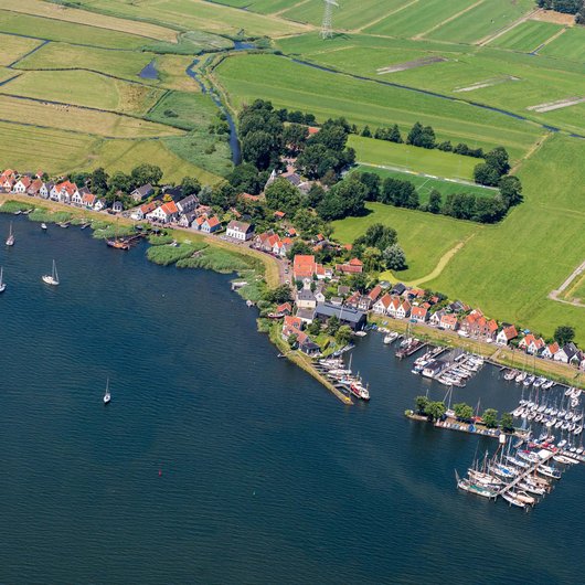
How to catch the unique character of Durgerdam in a few principle starting points?

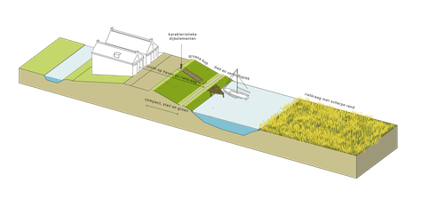
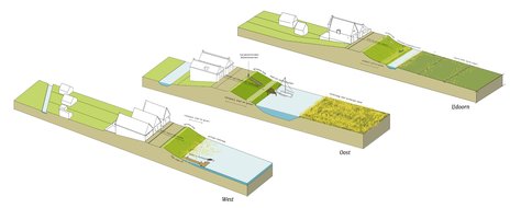
The measures for water safety in the various parts of Durgerdam (west end, east end, IJdoorn) are a ‘family’ in spatial terms. Big differences in implementation and appearance must be avoided. The structure of the existing profile per part must be maintained as much as possible. The varied nature of the informal zone directly along the facades is also of great importance.

The current dyke profiles are related to each other as a ‘family’

Approach

The ISP is a product of various themes (cultural history, nature, recreation, sustainability, traffic & parking, public space and water safety), that make up an integral and coherent perspective. In a year, close cooperation took place between residents, the design team, the technical team and governments. The collaboration took shape in studios and even an exhibition.

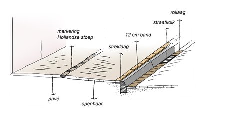
Characteristic structure sidewalk © Palmbout Urban Landscapes
Durgerdam

Results

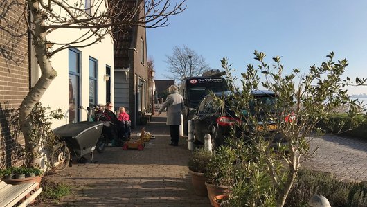
The informal and special character of the dyke is described in principles with care, customization and precision. The following qualities of the public space and dyke that are raised and should be payed attention to are: the informal use of the sidewalk, characteristic curves of the dyke, irregular shaped reed collars, small piers, dyke steps, the (grassy) dyke slope and more.

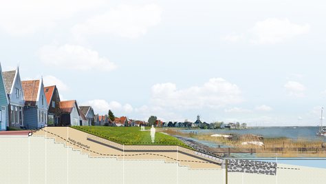
Visualization preferred proposal for the east end

Continuation

The ISP was determined by the directors of the three governments and residents on 26 February '19. With these starting points in hand, the work on the concrete design for flood risk management and public space begins. During this process, which is expected to take place throughout the whole year 2019, the governments will continue to engage with the village and their representatives.

On the website of the HHNK you can stay up to date with the news about the developments in Durgerdam.

Visualization preferred proposal for IJdoorn